Sudbury Aqueduct Waste Weir Control House // 1878

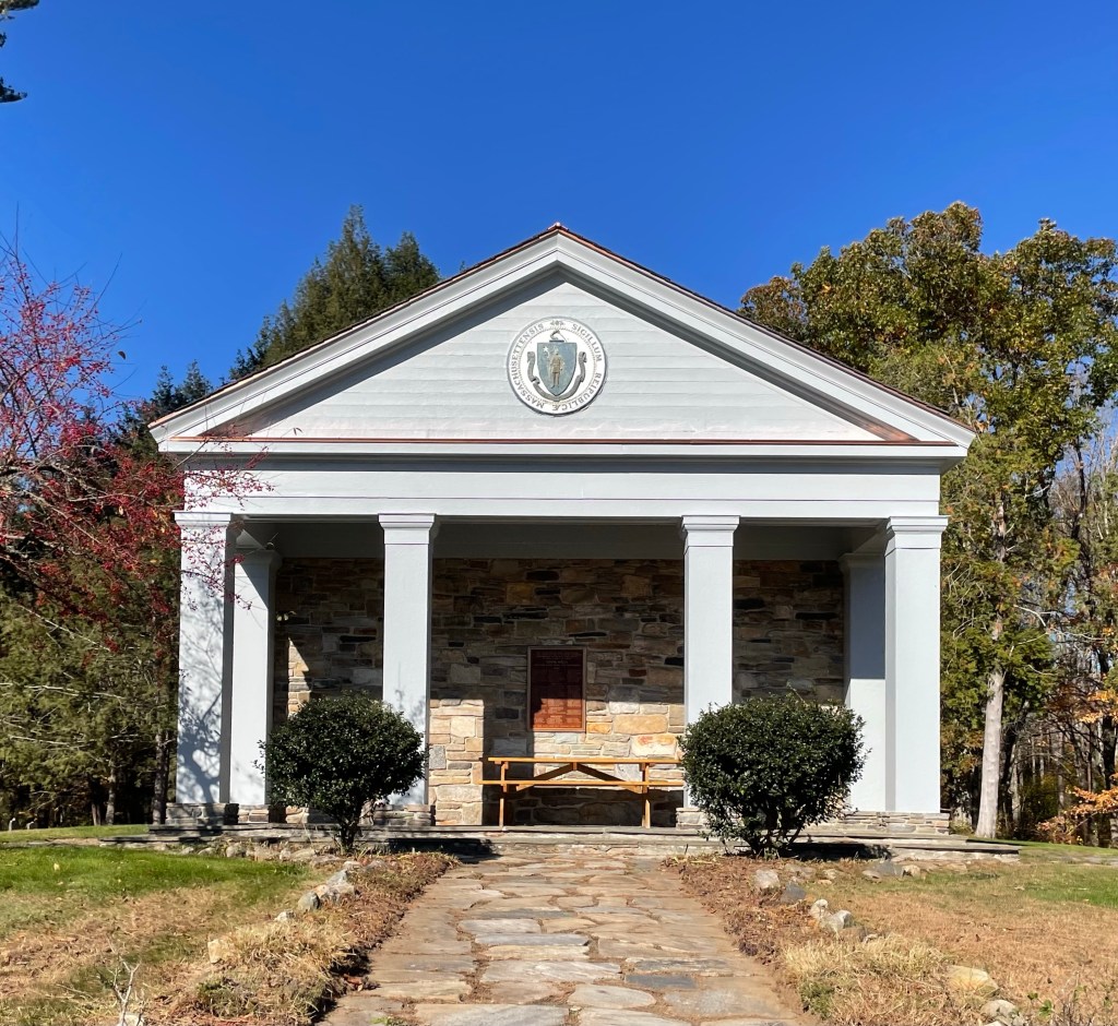
The Sudbury Aqueduct was constructed between 1875 and 1878 and runs for 16 miles from Framingham, Massachusetts to the Chestnut Hill Reservoir in Boston, and was in use for almost 100 years. It was designed to carry water from the watershed of the Sudbury River to Boston and its surrounding communities, supplying the ever growing metro area with fresh drinking water. Along the route, meter and control houses were built along with the Echo Bridge, to guide the running water to Boston for distribution all over the city. City architect of Boston, George A. Clough designed many of the structures along the route including this waste weir structure in Newton Centre. The weir was known as “Clarks Waste Weir” as it was built on the edge of land owned by Charles P. Clark. The aqueduct was taken out of regular service in 1978 but remains an emergency backup. Much of the aqueduct’s route is open to the public as an unimproved walking trail.

Spot Pond Gatehouse // 1900

The Middlesex Reservoir and Spot Pond are located just north of Boston and have long been a little piece of the outdoors near the heart of New England’s largest metropolitan area. In 1894, the Massachusetts Legislature established the Metropolitan Parks Commission, which was endowed with the authority to acquire, maintain, and make recreational spaces available to the public. By 1900 the new commission had acquired 1,881 acres for the reservation. Part of this reservation, Spot Pond, is a natural water feature that for a number of years was integrated into the Boston area public drinking water supply, servicing the towns of Stoneham, Melrose, and Malden with drinking water. As part of this, gatehouses were built with hardware to open and close the pipes delivering the water to the adjacent towns. This gatehouse is in Stoneham was built in 1900 by the architectural firm of Shepley, Rutan & Coolidge, to not only protect the machinery inside, but to beautify the parkland, then maintained by the Metropolitan Parks Commission. The Renaissance Revival style building is today surrounded by a tall chain link fence, which really diminishes its presence in the landscape (but it does help prevent graffiti).

Quabbin Park Cemetery Building // 1940

By the early 1900s, metropolitan Boston’s demands for freshwater began exceed its supply, causing the state legislature to look for other sources of water to supply the metro’s population growth. A 1922 study endorsed the Swift River Valley (Quabbin area) as the best location for a new reservoir that could supply Massachusetts with fresh water, but there was one issue, there were towns and people living there. To create the Quabbin Reservoir, the depressed land would need to be flooded, this required over 80,000 acres of land to be purchased or seized by eminent domain by 1938. Four towns: Dana, Enfield, Greenwich, and Prescott were disincorporated and their excess land not flooded was added to surrounding municipalities. In total, an estimated 2,500 residents lost their homes as part of the flooding. Not all elements of the towns were destroyed, however. Town memorials and cemeteries in the four towns were moved to Quabbin Park Cemetery, in Ware, a short distance from the Quabbin Reservoir. Many other public buildings were moved intact to other locations (like those in Dorset, Vermont featured previously). In the over 80,000 acres that were flooded, the Commonwealth had to relocate an estimated 7,500 burials in over 35 cemeteries in these flooded towns. Bodies were removed from their respective locations, and intered in the new Quabbin Park Cemetery, built by the Commission in 1932 with grounds designed by landscape architect Arthur A. Shurcliff. An area for unknown graves and a memorial area at the entrance to the cemetery also contains public war monuments from the abandoned towns. This service building was added to the cemetery from designs by architect Frederick Kingsbury who died during its construction.