Freeport Street Power Station // 1896

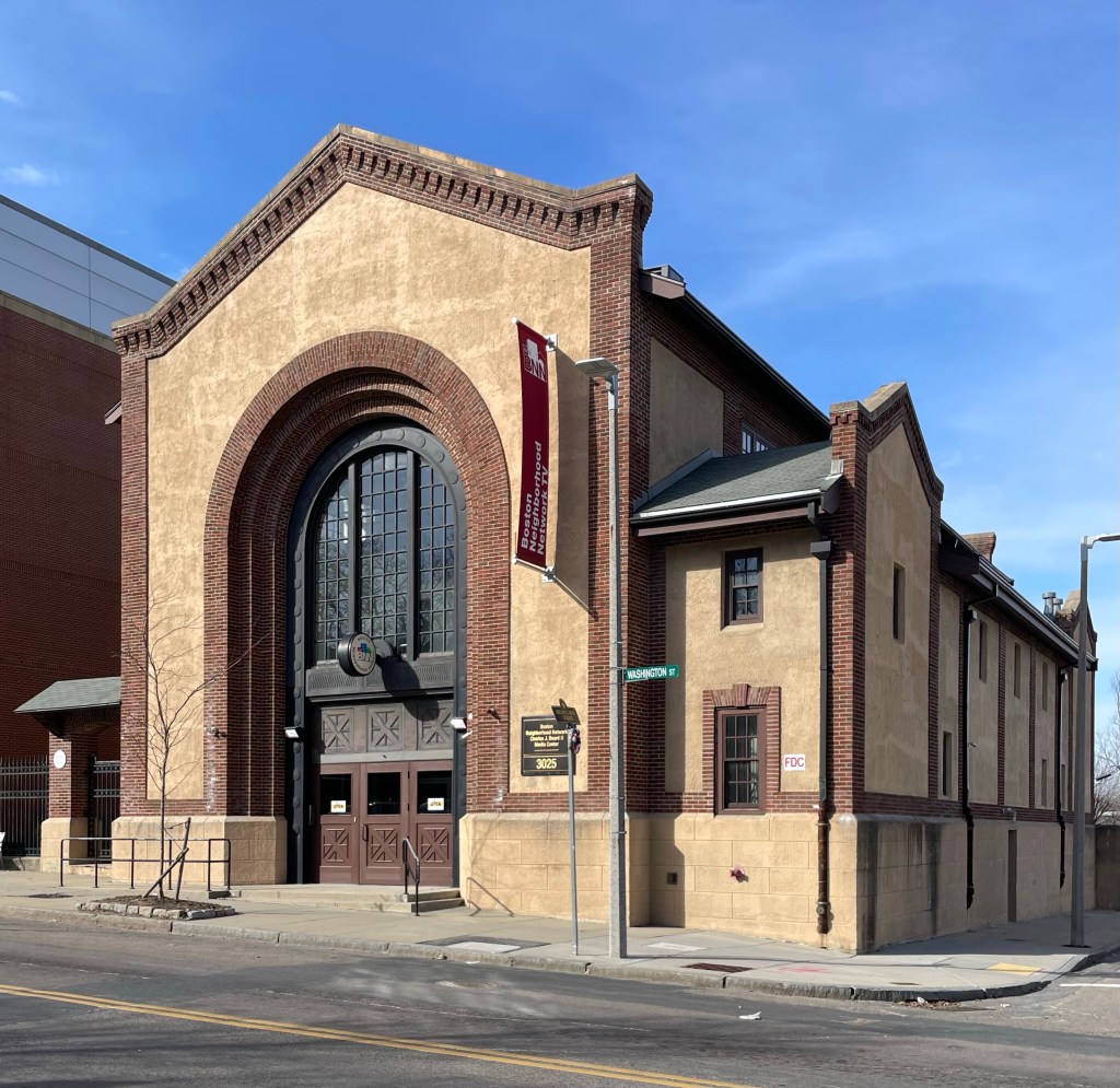
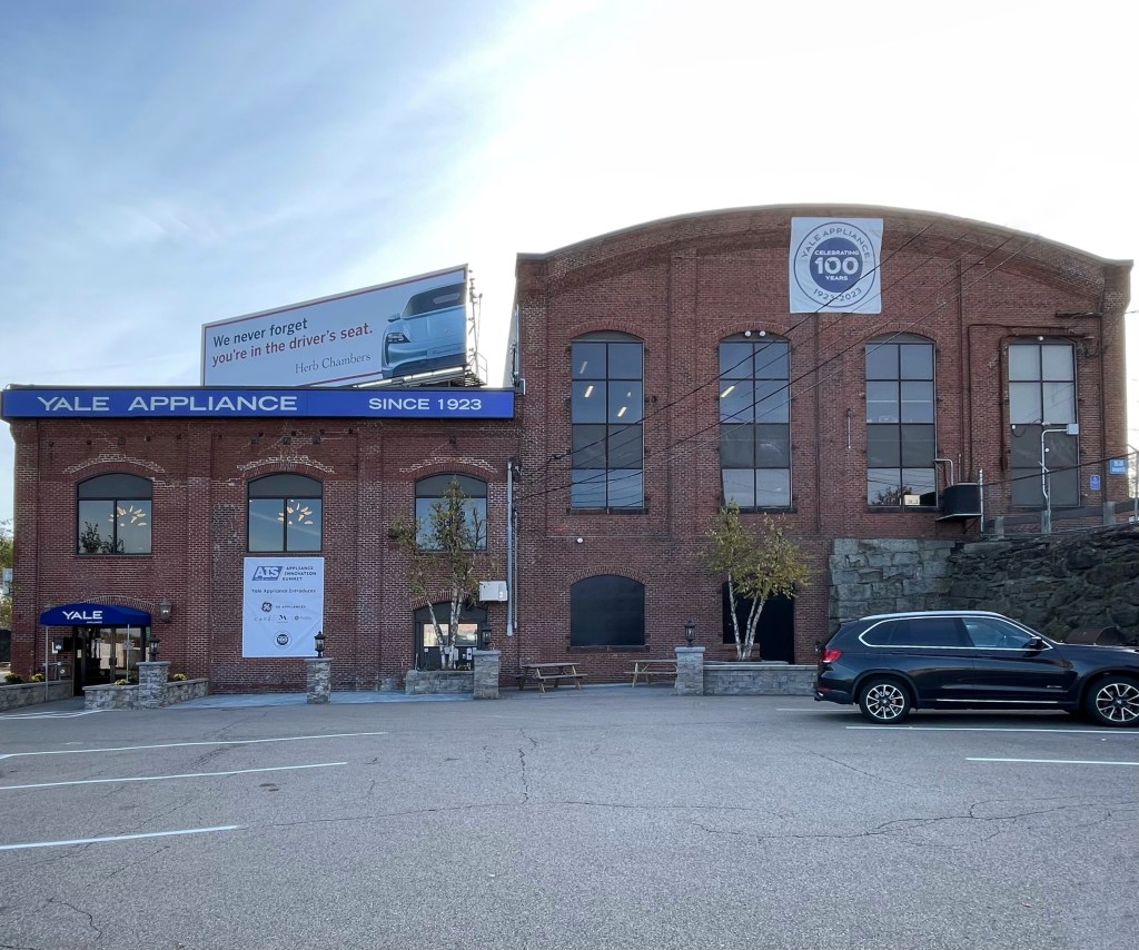
The West End Street Railway was established in 1887 originally as an offshoot of a land development venture, but it rose to prominence when it merged several independent streetcar companies into a single organization. Over the next decade, it became the primary operator of public street transit within the Boston area! During this time, the company maintained one of the largest street railway systems in the world, the first unified streetcar system in the United States, and first electrified system in a major US city. Now, it’s the infamous MBTA. How far they fall… Power plants were needed all over the city to provide electrical power for the company’s street cars, this was the fourth (and final) power station built, and it powered the Dorchester, Neponset, Ashmont and Milton lines. The station was constructed in 1896 on the shores of Dorchester Bay, which allowed for coal to be delivered in barges to the plant. Old stone walls formerly lining the shore can be seen to this day. Landfilling in the second half of the 20th century and the construction of I-93 have since cut off the building from the shore. Eventually the building was sold off and today is home to Yale Appliance, good thing none of their products are coal powered!

Egleston Square Substation // 1909

Streetcar suburbs of Boston have long been connected to the city by horse-drawn streetcars. As the city expanded and transportation shifted electrical, things changed in a big way! By the time the last horse-drawn streetcar was retired in 1897, the West End Street Railway Company had replaced its fleet of 9,000 horses with electric streetcars. Things were built upwards, with an elevated railway constructed between 1898 and 1901 that ran down Washington Street in the Roxbury neighborhood of Boston along the boundary of Jamaica Plain. The route had a stop in the middle of Egleston Square, with the surrounding neighborhood largely occupied by wood-frame, detached triple-deckers, two-family, and single-family houses, with many occupied by workers from the breweries nearby. Located on Washington Street in Roxbury, the Egleston Square substation was built in 1909 by the Boston Elevated Railway Company (predecessor of the Massachusetts Bay Transportation Authority) to convert AC (alternating current) electricity to DC (direct current) for use by its street railway cars and elevated cars. The building was designed by Robert S. Peabody of Peabody and Stearns, a prominent and expensive firm (yes the MBTA once invested in their infrastructure). After the station was effectively abandoned by the MBTA, the substation fell into disrepair, with a roof in failure in 2005. It was then acquired by Boston Neighborhood Network Media, a local nonprofit, who have converted it for use as office and television studio space. Scott Payette was the firm responsible for the intensive restoration and renovation.


Forest Hills Station // 1987

Photo courtesy of Cambridge Seven

While the demolition of the 1909 Forest Hills Station in Jamaica Plain (last post) was a huge architectural and historic loss for the city of Boston, the present building is a landmark in its own right. The present building was built in 1987 as a pivotal project in the MBTA’s Southwest Corridor Improvement Program, which was largely unfinished (thanks to neighborhood pushback and protests against the proposed highway to cut through the neighborhoods). The existing station, designed by local firm Cambridge Seven, is situated between two important points in Boston’s “Emerald Necklace” park system, and thus was given the appearance of a greenhouse by the architects. The distinctive clock tower, rising 120 feet above the station, signals the station location and is a nod to the days when stations once had prominent clocks to help passengers keep tabs on the time, before the days of cellphones!

Old Forest Hills Station // 1909-1987

Photo courtesy of Boston City Archives

When elevated train service from Boston extended to Forest Hills in Jamaica Plain in 1909, the residents of the surrounding neighborhoods and points south were ecstatic to realize the chance to enjoy quicker transit to the city. The station, which opened in 1909, was an architectural landmark and engineering feat, as the new terminal was the largest structure of its kind and the most costly in the country at the time. The large station was made of steel and reinforced concrete, finished in copper at the elevated section, and took nearly two years of construction. City architect Edmund M. Wheelwright designed the station, and upon its opening, it was called “the chef-d’œuvre of rapid transit development in Boston”. Like with many cities all over the country, shifting transportation planning and priorities and shrinking investment necessitated the once grand station to suffer the fate of the wreckingball. As part of the Southwest Corridor project, this station was to be demolished, with a modern station constructed to service the MBTA trains on the Orange Line. Also, plans were developed for a 12-lane highway along the railroad right-of-way between Boston through Cambridge. The residents of the affected areas, including Jamaica Plain, Roxbury, South End, Back Bay, and Cambridge, protested against the destruction of their neighborhoods by the planned highway, and won! The old Forest Hills Station was a casualty of the proposal, but a lasting reminder for neighborhood planning and advocacy, preserving character and people over cars.