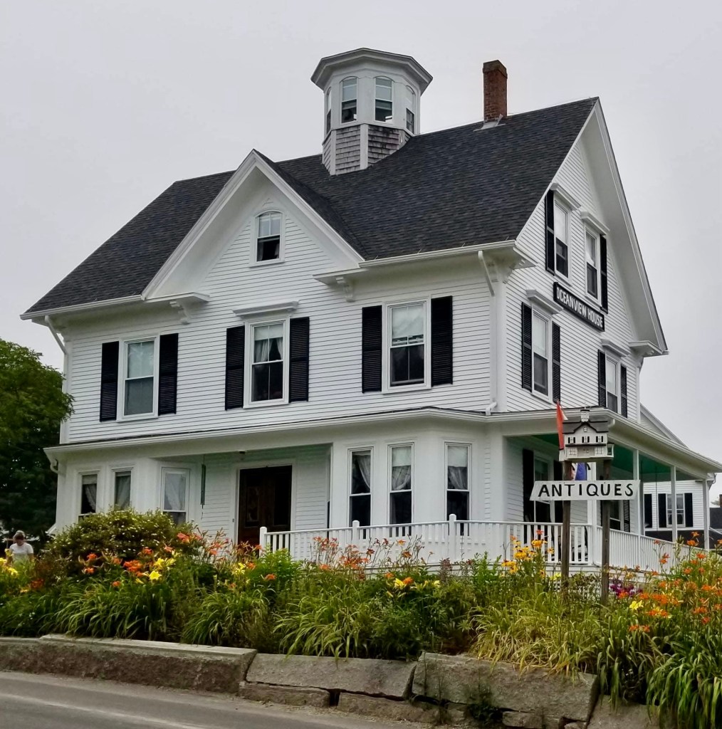
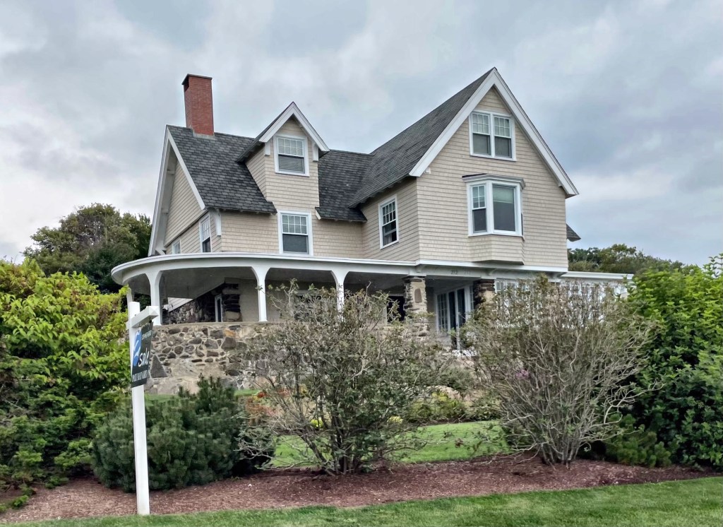
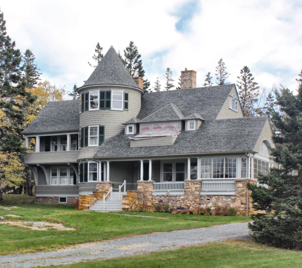
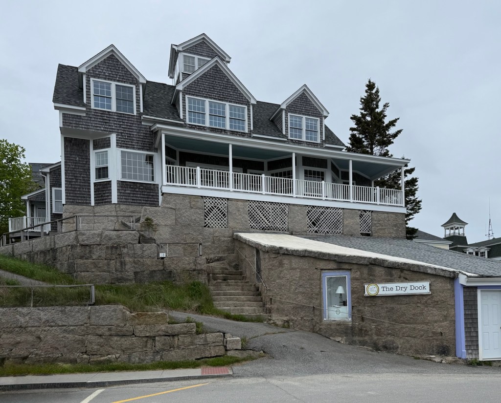
When you walk along Ogunquit’s Marginal Way cliff walk, it is missing one thing, an iconic Maine lighthouse… or is it? This mini lighthouse on the route always has people lining up to snap a picture and its quirky roadside attraction appeal is undeniable. The original Lobster Point Lighthouse was constructed in 1948 by Winfield C. Littlefield of the local family who first settled in the town. The “lighthouse” was designed by Grover S. Perkins. Much like the real lighthouses on the coast, the original structure was badly beaten by the salt air and high winds and parts of the structure were replaced. Notably, in 1993, the top (lantern) was replaced with fiberglass. Additionally, in 2009 the structure was upgraded, all from donations. The iconic roadside lighthouse will continue to ‘light the way’ for the droves of tourists and locals alike who navigate Marginal Way.
As Ogunquit surged in popularity as a coastal summer retreat in the late 19th century, the flocks of city-dwellers needed a places to rest their head after splashing in the crisp Maine ocean. The original structure began with a mid-19th century house, likely in the Greek Revival style. It was expanded in the 1880s when it opened as a hotel for tourists, equipped with a mansard roof. The hotel consistently sold out of rooms in the summer months and the proprietors decided to expand in about 1897 with a sizeable Queen Anne style addition. A fire in 1951 destroyed the rear wing of the building and the conical tower roofs were removed, resulting in the final form seen today. The hotel is historically significant because it is the only surviving 19th-century hotel in Ogunquit that still serves as a hotel and largely retains its historic appearance, enhanced following a 2013 restoration by the owners who worked with David Lloyd of Archetype Architects. Other hotels of the period have either been converted to condominiums or been engulfed by modern alterations. The hotel was thus placed on the National Register of Historic Places, a large, and worthy addition!
Ogunquit, which means “beautiful place by the sea” in the indigenous Abenaki language, was first a village within Wells, which was settled in 1641. Ogunquit grew as a fishing village with shipbuilding on quiet tidal waters protected within smaller alcoves. By the late 19th and early 20th centuries, the village was discovered by artists, who flocked to the area for the natural scenery and bucolic coastal scenes perfect for painting. At this time, summer residents came to the sleepy village en masse, facilitating the construction of summer resort hotels and commercial buildings. Ogunquit seceded from Wells in 1980, and has been one of the most visited villages in Maine. Ogunquit has been a destination for LGBT tourists and businesses, adding to the rich culture there. This church building, shows the history of the town well. It was constructed as the village’s Methodist Church after 1872 in a vernacular Gothic style with lancet windows and entry. The church merged with the nearby Wells Methodist Church in the 1970s and later moved to a new church building between the two towns. The former Ogunquit Methodist church was purchased and converted to a gift shop, frequented by locals and tourists alike.
Ram Island, about a mile offshore from Portland Head near the entrance to Portland Harbor in Maine, is surrounded by dangerous ledges. For as long as ships have been navigating Portland Harbor, they have crashed into the rocky shore, losing supplies and lives. Because of this, a Congressional act on June 28, 1902, authorized the construction of a lighthouse and fog signal on Ram Island Ledge, to work together with the Portland Head Light to guide ships through the treacherous channel. The next year, the federal government purchased Ram Ledge from two Cape Elizabeth families for $500, to erect a new lighthouse. Before the lighthouse could be constructed, at least two ships, the Glenrosa and the Cora & Lillian schooner sunk in the bay. As the ledge was underwater for much of the year, a stone tower was required. Granite from Vinalhaven was shipped in and a crew of 25 men built the tower which was complete in 1905. The iconic double flash of light has guided sailors ever since. The lighthouse was manned by multiple keepers until the late 1958, when an underwater power cable was laid between Portland Head and Ram Island Ledge, allowing the ledge lighthouse to be automated. In 2008, the structure was deemed “excess to the needs of the United States Coast Guard” and auctioned off. After a bidding war, a local doctor from Maine purchased it for an estimated $190,000.
Away from the busy coast of Kennebunkport, Clock Farm, a mid-19th century farmhouse with an odd clock-tower caught my eye while driving by. Clock Farm is a rambling extended farm complex that remains a landmark in the more rural section of town. According to historians, the oldest part of the complex was a home that was later converted to one of the ells, was built in 1773 by a Peter Johnson. By the 1850s, the 1 1/2-story Greek Revival home and barn were built. In the late 19th century, the property was purchased as a summer residence by Thomas Lemmons, factory owner in Lawrence, MA. The story associated with the clock is that originally was mounted on his factory, but kept such bad time that his employees complained. In the early 20th century Emmons had the tower specially built to house the clock, which was transported here from Lawrence.
Located on Wood Island, off the coast of Kittery, Maine, a Life Saving Station and tool shed were built by the Sugden Brothers of Portsmouth, N.H. for the US Life Saving Service. The station was designed by architect George R. Tolman of Portsmouth and its purpose was to house a small crew of men who could rescue shipwreck survivors or people who fall into the harbor at the mouth of the busy Piscataqua River. The station was acquired by the U.S. Coast Guard in 1915, who operated many of these stations off the rocky shores of the United States.
Life Saving Station with Whaleback Light to the left.
The U.S. Navy took over the Wood Island Life Saving Station early in World War II to help protect submarine manufacturing at the Portsmouth Naval Shipyard from German U-Boats patrolling the Atlantic Coast. In 1941 Wood Island was integrated into the coastal defense system. As a strategic observation post, the property was also utilized for securing anti-submarine nets, which were strung across the harbor to thwart German U-Boat infiltration. At the end of the war, the property reverted back to the U.S. Coast Guard. By 1950, the staff of the station moved to mainland and the two-building complex sat empty.
It was given to the Town of Kittery, Maine in 1973 and it suffered from a lack of funds and deferred maintenance. The town council had a committee analyze the options for the site, the “best option” was to demolish both structures and re-construct replicas at a cost of $350,000! The council saw that and opened up to alternatives which would save the building and offer an organization a low-to-free lease of the site. I believe that the site is being restored now and the intent is to serve as a historical museum highlighting the Life Saving Station and the Whaleback Light nearby.
Originally called Fort William after William Pepperell, who owned much of the land which is known today as Kittery Point, this fortification was constructed on high ground at the mouth of the Piscataqua River. Some sources state that the fort was additionally intended to protect Maine (then part of Massachusetts) from “unreasonable duties” (taxes) that the Governor of New Hampshire was attempting to impose on citizens receiving goods via the river, which straddles the two states. After the Revolution, the fortification was transferred to the United States government, and later renamed Fort McClary, after a New Hampshire native Major Andrew McClary, an American officer killed in the Battle of Bunker Hill. None of its original features or earthworks are known to remain from this period.
Map of current Fort McClary structures.
The largest building period at the fort occurred in the 1840s, when the large hexagonal blockhouse was built atop a raised granite block first story. Additional outbuildings were constructed including: a barracks, powder magazine, a rifleman’s house and more. My favorite and relatively hidden structure as part of the fort complex is the caponier (also labeled as a bastion). The structure is subterranean and features massive brick vaulted ceilings. The fort and buildings are part of a State Parks system in Maine.